


Ridge Hikes We Love (and Think You Will Too)
There’s nothing quite like standing on a crest, surrounded by mountains stretching in every direction.

Opal Ridge
If a hike has “ridge” in its name, chances are we’ll love it. Ridge hikes are a favourite of ours because of the incredible views they offer. There’s nothing quite like standing on a crest, surrounded by mountains stretching in every direction.
Those views don’t typically come easy, though. Ridge hikes often mean steep, challenging climbs and narrow trails, sometimes with considerable drop-offs. The descent can be just as tough. If you’re new to hiking, ridge trails are not the best place to start. They’re better suited for intermediate to advanced hikers.
Summer is the perfect time for ridge hikes, with dry trail conditions and wildflower-filled slopes adding to the reward. And speaking of summer, today is Summer Solstice. Happy official start of summer! We’re looking forward to a summer filled with outdoor adventures, and hope you are too.
Back to ridge hikes… do your research before heading out. Check trail conditions through sources like Parks Canada, Alberta Parks, Gem Trek Maps or hiking guidebooks, rather than relying only on AllTrails or Instagram. Check annual road closures too — Highway 40, for example, is not completely open until tomorrow. And while you should always pack for variable weather, exposure on ridges makes layers and wind protection even more essential.
Read on for six of our favourite ridge hikes. Are we missing any of your favs? Let us know in the comments.
King Creek Ridge
King Creek Ridge is a challenging and steep hike with stunning 360 degree views of Kananaskis. Be prepared for a relentless climb, followed with views that make all that effort worth it. There’s a false summit at the end of the ascent, with the actual summit about 10 minutes further along the ridge. The descent is steep and loose, so take your time (and bringing poles may help). Check out this Play Outside Guide post for more detailed instructions.
Distance: 7 kilometres round trip
Elevation Gain: 750 metres
Getting There: Park at the King Creek Day Use Trailhead, located down Highway 40. Once parked, walk back to Highway 40 and turn right. The trail follows the road for a brief distance before veering uphill. Stay left at the first junction to go to the ridge.
Forgetmenot Ridge
A ridge hike and a trail bursting with wildflowers… what more could you want? This lesser-known trail is located near Bragg Creek, with a trailhead that’s a bit tricky to find. Plus when Cailynn hiked here in late June a few years ago, it was necessary to cross a river, walking in shin-deep water. Things get simpler after that. While the views are stunning, she was just as captivated by the colourful blooms. She spotted forgetmenots, cinquefoil, rock cress and vetch brightening the grassy slopes, as well as sweetflower rock jasmine and an uncommon alpine springbeauty among the jagged rocks.
Distance: 14 km roundtrip
Elevation Gain: 715 m
Getting There: Take Highway 66 from Bragg Creek all the way to the junction with the Powderface Trail. Turn left to stay on asphalt and follow it towards the Little Elbow Campground. You’ll need a Kananaskis Conservation Pass, and note the trailhead is tricky to find — be sure to research online or consult guidebooks for detailed instructions.
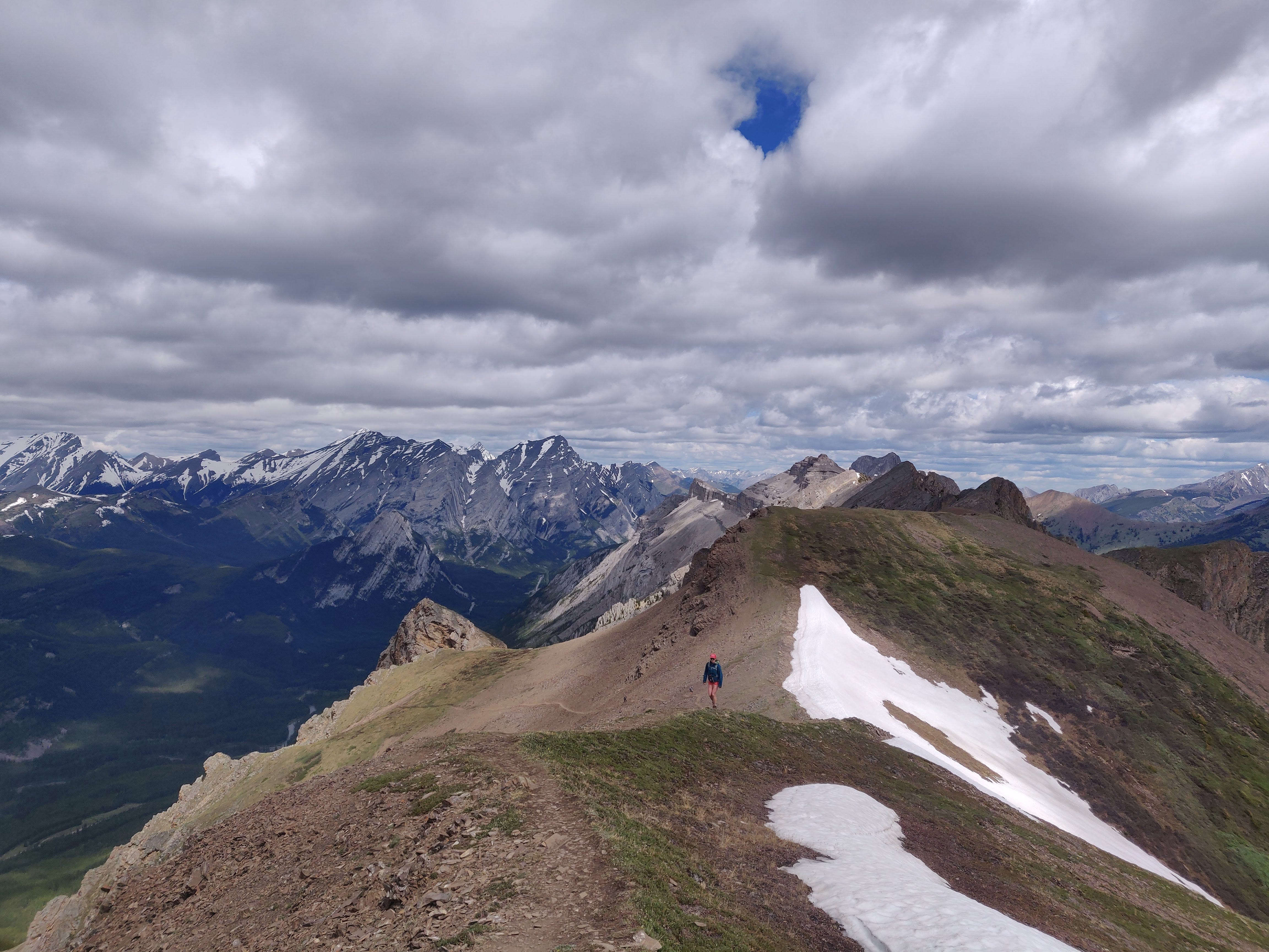
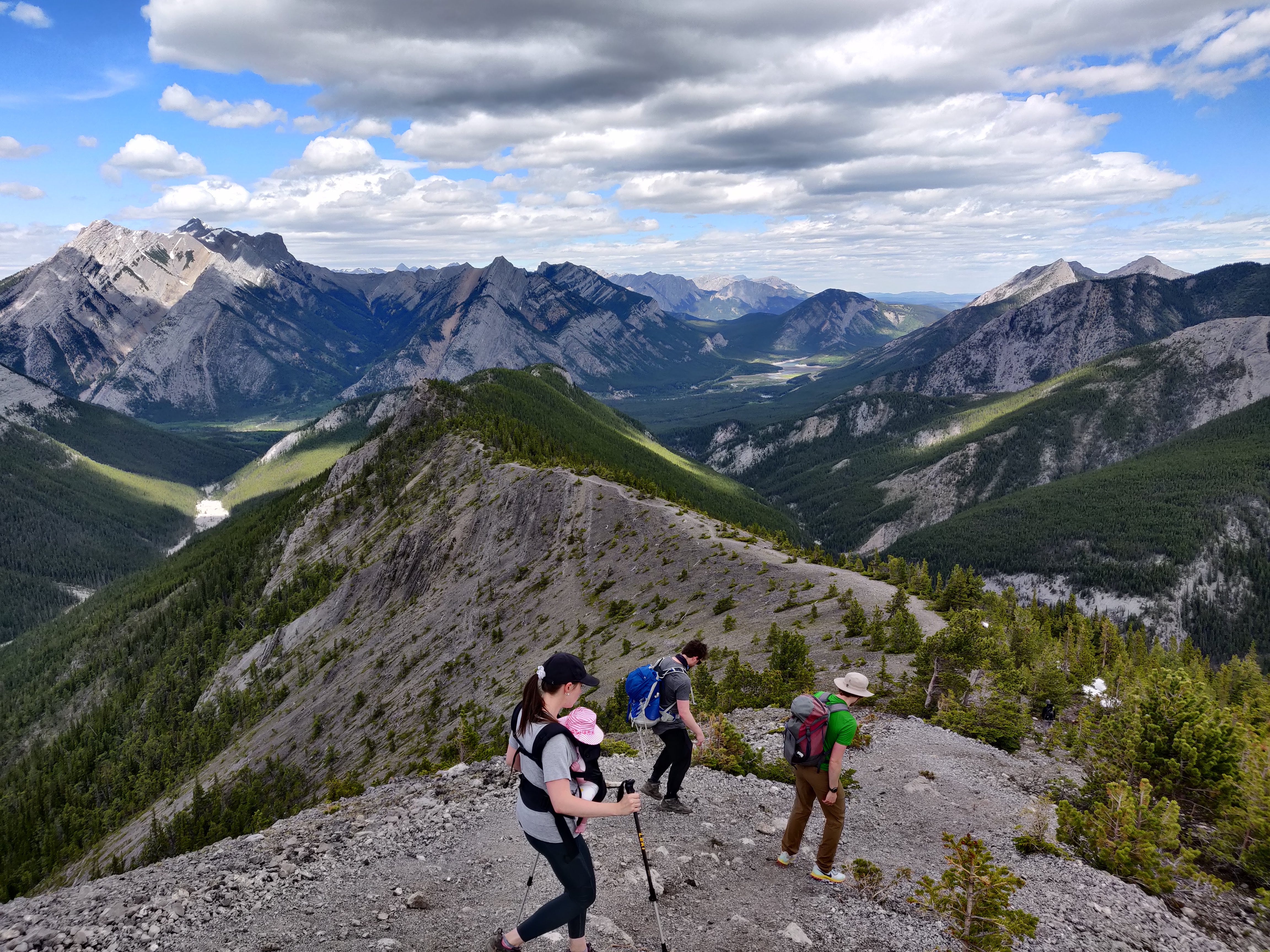
Opal Ridge
Opal Ridge is another gorgeous Kananaskis hike featuring a steep climb and expansive views. While the very start of the hike involves some route finding and is rather bland, you’ll quickly be surrounded by scree. Keep on climbing and you’ll eventually hike up between two big rock pillars or gates that lead to stunning views. This Hike Bike Travel post provides more details.
Distance: 8 kilometres roundtrip
Elevation Gain: 1,000 metres
Getting There: Park at the Fortress Gas Station and start at the north end of the lot. You’ll hike up a small creek that gets you to a road with a powerline overhead. After about 10 minutes start looking for a steep unmarked trail on your right. The trail goes through a forest for about 20 minutes before opening onto a slope.
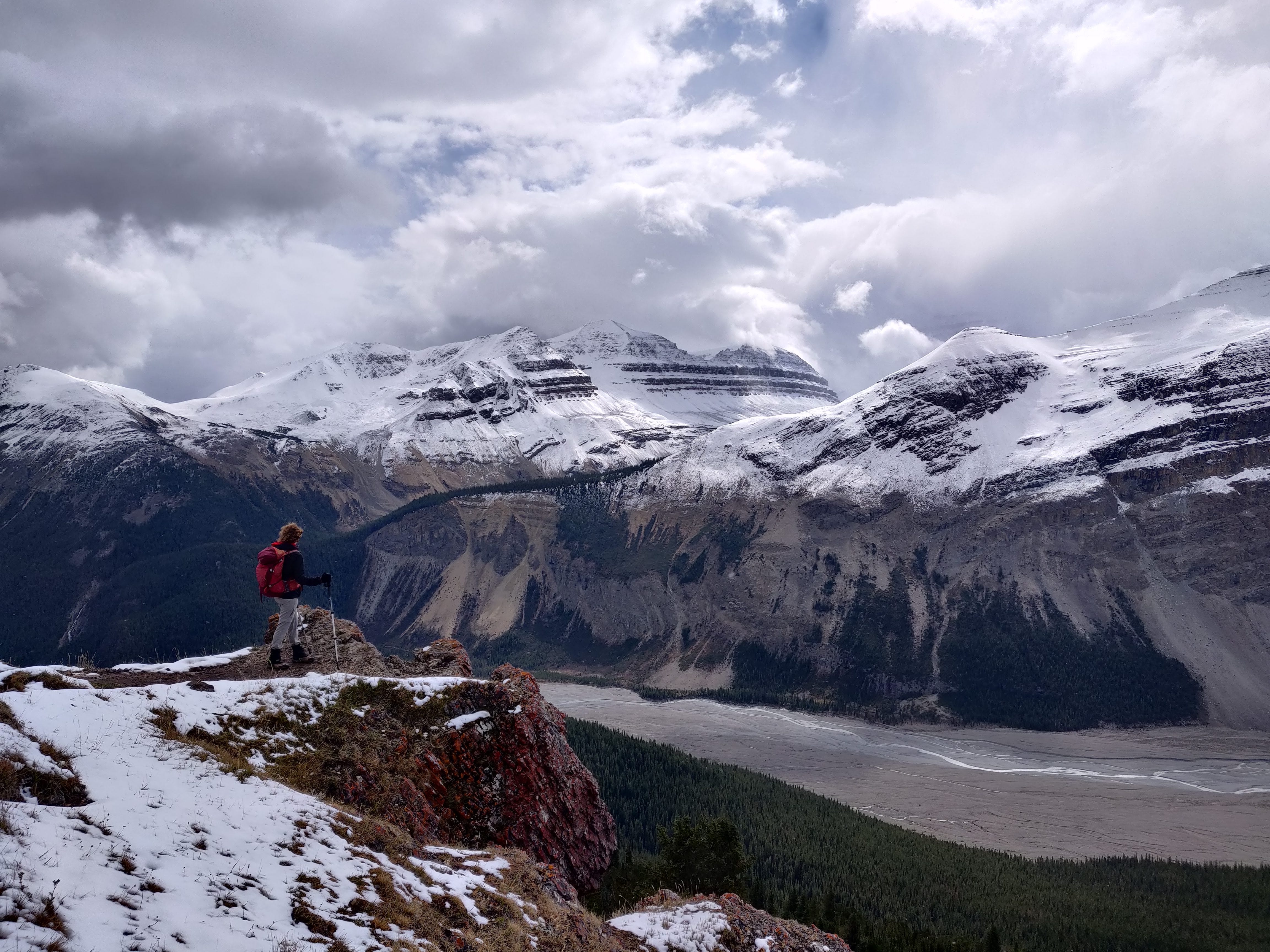
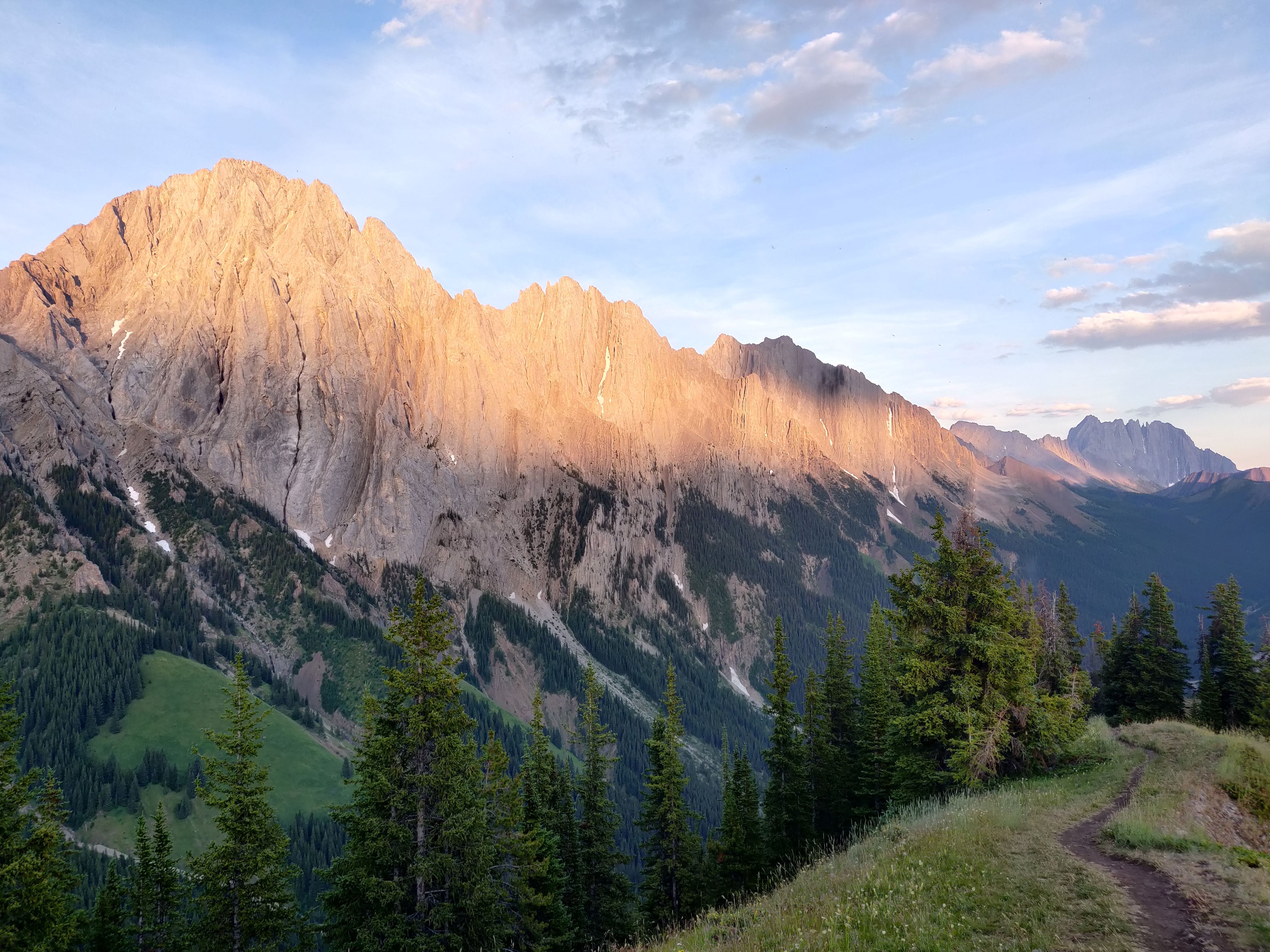
Parker Ridge
Parker Ridge is a popular hike along the Icefields Parkway in Banff National Park. It’s a bit far to drive to the trailhead, but the hike itself is short and not-at-all technical, meaning minimal effort for incredible views. After a set of switchbacks, you’ll pop above the trees and soon see sweeping glacier views — including the impressive Saskatchewan Glacier, source of the Saskatchewan River. Watch for snow well into June and starting again in September (the photo above was taken in September).
Distance: 5.4 km roundtrip
Elevation Gain: 305 m
Getting There: Follow directions to the Parker Ridge Trailhead on Google Maps. The parking lot is located 40 km north of Saskatchewan Crossing or 9 km south of the Icefield Centre on Hwy 93N.
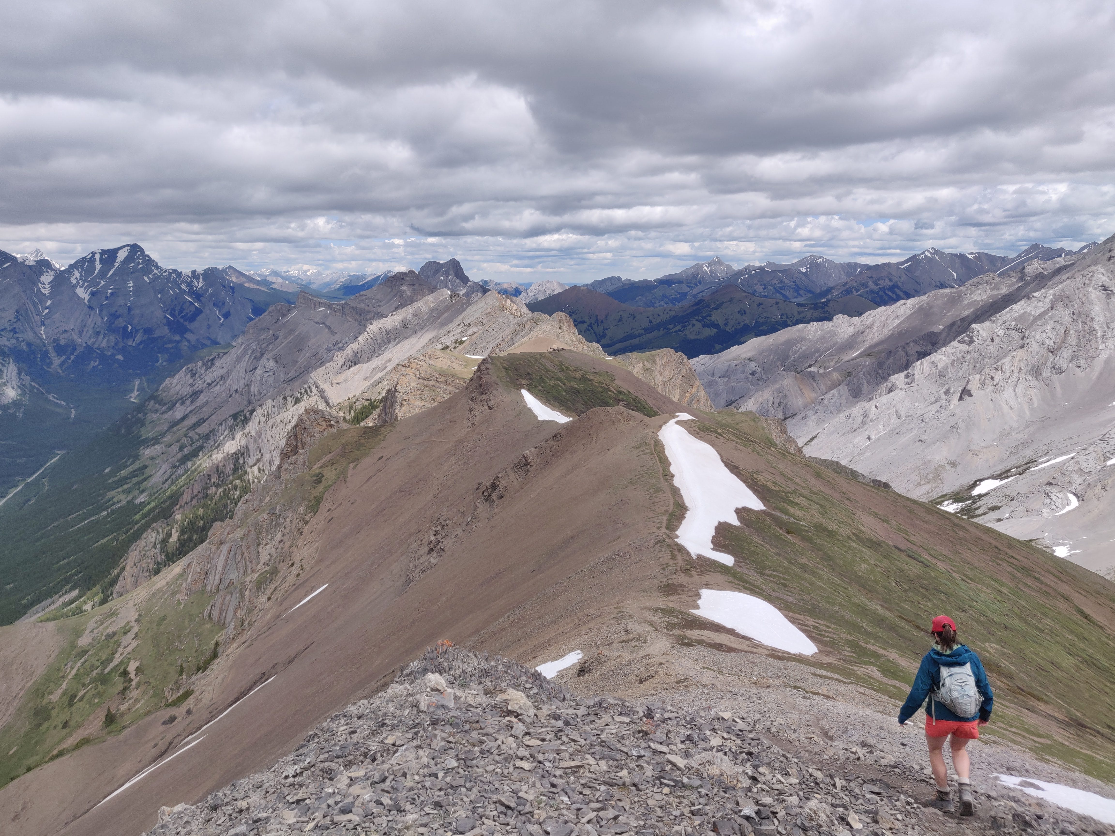
Wasootch Ridge
Also located in Kananaskis, Wasootch Ridge is another favourite. It’s a straightforward and steep trail that quickly leads to stunning views (like 25 minutes quick). There are also options once you’re on the ridge, meaning you can choose your own adventure. Find good views without going all the way to the true summit, or do the difficult scramble to the true summit. This Banff Blog post has more details.
Distance: About 13 kilometres roundtrip (if you go to the true summit and come back the same way. Note that few people go to the tricky true summit, most turn back 1 kilometre before.)
Elevation Gain: Up to 1,00 metres
Getting There: Park at the Wasootch Day Use Area. The trailhead is behind the picnic tables (which are in the trees, across from the toilets.) There are three different trails to choose from and we recommend the trail leading from the picnic table on the right.
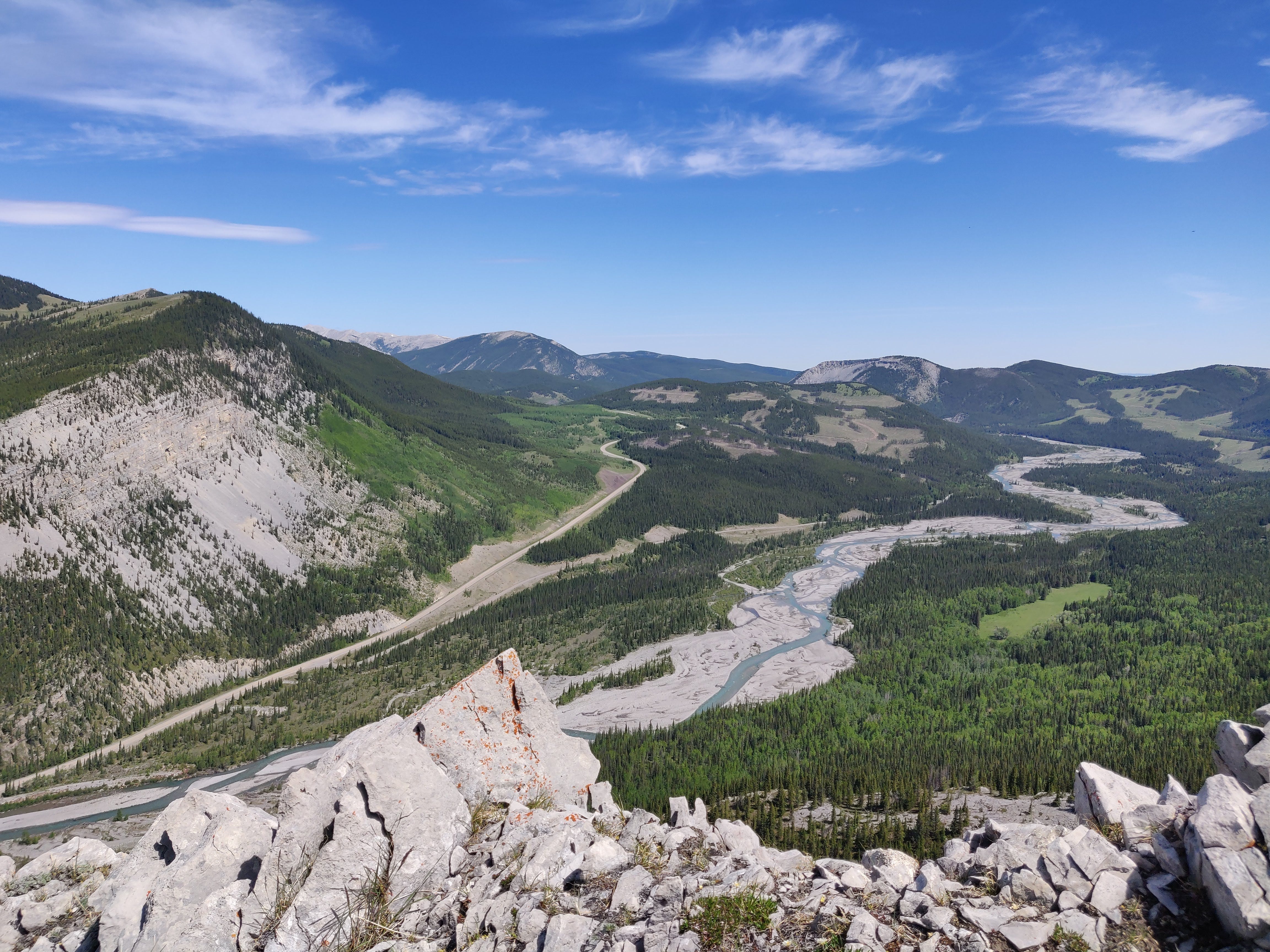
Wind Ridge
This steep trail just outside of Dead Man’s Flats lives up to its name — it’s one of the windiest hikes in Alberta, so come prepared with layers. After a mellow start, things get steeper and more rugged around the five-kilometre mark. After steep climbing you’ll reach a fairly straightforward ridge walk, offering expansive views — especially impressive for a hike so close to Calgary. If you’re not up for the full effort, Windy Viewpoint offers a scenic midway reward. Just don’t forget: this trail is closed Dec 1 to June 15 each year to protect wildlife.
Distance: 12.8 km roundtrip
Elevation Gain: 860 metres
Getting There: Driving from Calgary, take the Trans-Canada Highway to Dead Man’s Flats (exit 98). Turn right on 2nd Street, right on 2nd Avenue and cross the highway. 2 Ave becomes George Biggy Sr. Road, and you’ll follow this to the parking lot at the end of the road.
Ridge Hike Reminders
Pack lots of water! Unlike other hikes, there are rarely opportunities to refill from streams and rivers. In addition, the steepness is taxing. Make sure you pack plenty of water as you’ll need it.
Always carry bear spray and check yourself for ticks after your hike.
While you should always pack for variable weather conditions, this is particularly important on ridge hikes when you’re very exposed to the elements. Ridges can be extra windy so layers are important.
Be prepared for snow, even into late June/early July. Check conditions before you go, as microspikes and poles may be necessary.
You don’t have to go to the true summit! A lot of ridge hikes offer stunning views very quickly.
P.S. It’s subscriber summer!
What’s that, you ask? It’s our seasonal push to help more people discover Go Outside. This newsletter is a passion project, and one of the best parts of doing this is hearing from readers who say it’s helped them head outdoors — whether that means trying a new trail, packing a smarter snack, attempting a new activity, or just feeling more comfortable outside.
We want to help more people go outside. If you enjoy what you read here, please consider forwarding a post to a few friends and encouraging them to subscribe. That small action makes a big difference — and helps grow this community of curious, trail-loving, snack-packing outdoor folks.

These are gorgeous! Makes me wish our snowpack would hurry up and melt, so I could get to my favorite ridge hike in Colorado!